 vesseltracker.com
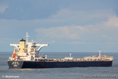
Vessel ES BROAD SEA IMO: 9482677, MMSI: 477891400 Bulk Carrier
UTC, 21.97667, 119.01333, course: -1, speed: 8
UTC, 22.39813, 119.32201, course: -1, speed: 8.6
2026-03-04 07:38:22 UTC, 22.52729, 119.44678, course: -1, speed: 8.8
Live AIS position:
UTC. 45 nm W of YUNG AN),
updated 2026-03-04 07:38:22 UTC.
Find the position of the vessel ES BROAD SEA on the map. The latter are known coordinates and path.
marine traffic ship tracker show on live map
The current position of vessel ES BROAD SEA is 22.52729 lat / 119.44678 lng. Updated: 2026-03-04 07:38:22 UTCCurrently sailing under the flag of Hong Kong
Details:
Last coordinates of the vessel:
UTC, 21.76833, 118.86333, course: -1, speed: 8UTC, 21.97667, 119.01333, course: -1, speed: 8
UTC, 22.39813, 119.32201, course: -1, speed: 8.6
2026-03-04 07:38:22 UTC, 22.52729, 119.44678, course: -1, speed: 8.8